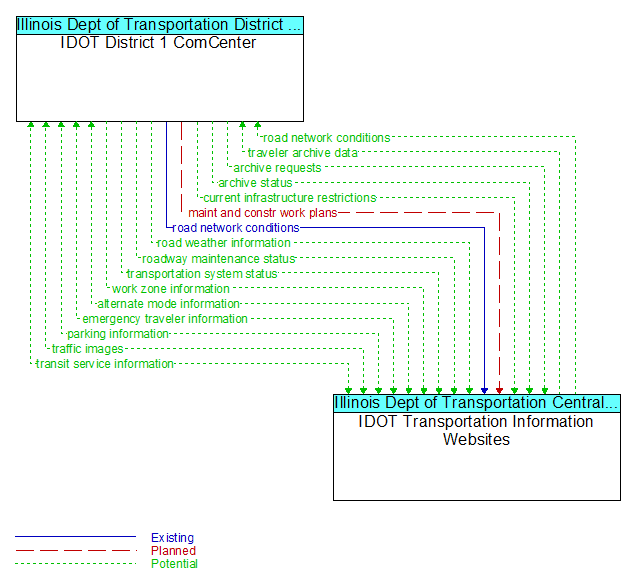
Interface: IDOT District 1 ComCenter - IDOT Transportation Information Websites
Architecture Flow Definitions
alternate mode information (Potential) Applicable ITS Standards
Schedule information for alternate mode transportation providers such as air, ferry, and passenger–carrying heavy rail.
archive requests (Potential) Applicable ITS Standards
A request to a data source for information on available data (i.e., "catalog") or a request that defines the data to be archived. The request can be a general subscription intended to initiate a continuous or regular data stream or a specific request intended to initiate a one–time response from the recipient.
archive status (Potential) Applicable ITS Standards
Notification that data provided to an archive contains erroneous, missing, or suspicious data or verification that the data provided appears valid. If an error has been detected, the offending data and the nature of the potential problem are identified.
current infrastructure restrictions (Potential) Applicable ITS Standards
Restrictions levied on transportation asset usage based on infrastructure design, surveys, tests, or analyses. This includes standard facility design height, width, and weight restrictions, special restrictions such as spring weight restrictions, and temporary facility restrictions that are imposed during maintenance and construction.
emergency traveler information (Potential) Applicable ITS Standards
Public notification of an emergency such as a natural or man–made disaster, civil emergency, or child abduction. This flow also includes evacuation information including evacuation instructions, evacuation zones, recommended evacuation times, tailored evacuation routes and destinations, traffic and road conditions along the evacuation routes, traveler services and shelter information, and reentry times and instructions.
maint and constr work plans (Planned) Applicable ITS Standards
Future construction and maintenance work schedules and activities including anticipated closures with anticipated impact to the roadway, alternate routes, anticipated delays, closure times, and durations.
parking information (Potential) Applicable ITS Standards
General parking information and status, including current parking availability, parking pricing, and parking space availability information.
road network conditions (Existing) Applicable ITS Standards
Current and forecasted traffic information, road and weather conditions, and other road network status. Either raw data, processed data, or some combination of both may be provided by this flow. Information on diversions and alternate routes, closures, and special traffic restrictions (lane/shoulder use, weight restrictions, width restrictions, HOV requirements) in effect is included.
road weather information (Potential) Applicable ITS Standards
Road conditions and weather information that are made available by road maintenance operations to other transportation system operators.
roadway maintenance status (Potential) Applicable ITS Standards
Summary of maintenance fleet operations affecting the road network. This includes the status of winter maintenance (snow plow schedule and current status).
traffic images (Potential) Applicable ITS Standards
High fidelity, real–time traffic images suitable for surveillance monitoring by the operator or for use in machine vision applications. This flow includes the images and meta data that describes the images.
transit service information (Potential) Applicable ITS Standards
Transit service information including routes, schedules, and fare information as well as dynamic transit schedule adherence and transit vehicle location information.
transportation system status (Potential) Applicable ITS Standards
Current status and condition of transportation infrastructure (e.g., tunnels, bridges, interchanges, TMC offices, maintenance facilities). In case of disaster or major incident, this flow provides an assessment of damage sustained by the surface transportation system including location and extent of the damage, estimate of remaining capacity and necessary restrictions, and time frame for repair and recovery.
traveler archive data (Potential) Applicable ITS Standards
Data associated with traveler information services including service requests, facility usage, rideshare, routing, and traveler payment transaction data. Content may include a catalog of available information, the actual information to be archived, and associated meta data that describes the archived information.
work zone information (Potential) Applicable ITS Standards
Summary of maintenance and construction work zone activities affecting the road network including the nature of the maintenance or construction activity, location, impact to the roadway, expected time(s) and duration of impact, anticipated delays, alternate routes, and suggested speed limits. This information may be augmented with images that provide a visual indication of current work zone status and traffic impacts.